Current Issue
No. 177 (2026): ACMLA Bulletin Winter 2026
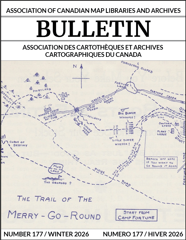
Cover image: "The Trail of the Merry-Go-Round" Map (1929)
Ottawa Ski Club News. 30 Jan 1929 From Charles Hodgson (https://www.gvhs.ca/research/maps/gp-trail1-maps.html)
Thanks to Renna Truong for submitting this issue's cover map.
Published:
2026-03-20