The Cartoon-Style Poster Maps of Trans Continental Cartographers Ltd., Vancouver, B.C.
DOI :
https://doi.org/10.15353/acmla.n172.5459Mots-clés :
Map Ephemera, Promotional Posters, Pictoral Maps, CanadaRésumé
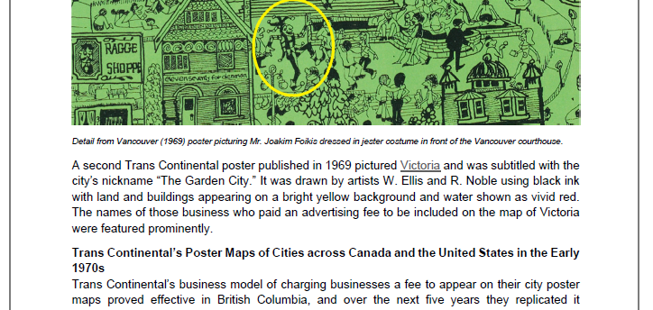
This article provides information about the stylized poster maps created in the late 1960s and early 1970s by Trans Continental Cartographers Ltd., Vancouver, B.C. These maps, which depicted cities across Canada and the United States, contained pictorial views of popular landmarks, buildings and places of interest. The restaurants, shops, stores and other attractions portrayed often paid an advertising fee to be represented on Trans Continental’s “city character maps,” which were drawn in a quirky and humorous cartoon style at an enlarged scale.

Téléchargements
Publié-e
Comment citer
Numéro
Rubrique
Licence
© Rhys Stevens 2023

Cette œuvre est sous licence Creative Commons Attribution - Pas d'Utilisation Commerciale 4.0 International.
Authors retain the copyright to their work by using Creative Commons licenses. The Creative Commons Attribution-NonCommercial license applies to all content unless authors elect to choose a more restrictive license for their work. If you reuse the content, you must give appropriate credit; you may not use or redistribute the material for commercial purposes.


