Exploring Canadian Geospatial Data with GeoPandas in Colab Notebooks
DOI:
https://doi.org/10.15353/acmla.n173.5671Keywords:
Google Colab, Python, GeoPandas, Open Source, Statistics Canada, CartographyAbstract
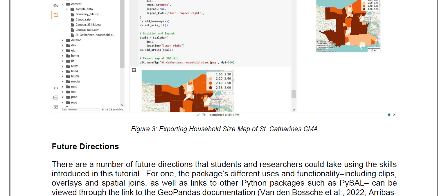
Google Colab with the GeoPandas Python package is an effective platform for GIS analysis. Following a tutorial prepared by the author, this review discusses how users can load, project, query and visualize GIS data through graphs and maps. Future directions of where this platform could be taken are also discussed. Lastly, the benefits and drawbacks of GIS analysis with Google Colab are presented.
References
Arribas-Bel, D., Knaap, E., Barcelos, G., Shao, H., Gaboardi, J., Sauer, J., et al. (2020). PySAL. https://pysal.org/
Google. (n. d.). Welcome to Colaboratory - Colaboratory. https://colab.research.google.com/notebooks/intro.ipynb
Ontario Council of University Libraries (n. d.). Scholars GeoPortal. geo.scholarsportal.info
Rogerson, P. A. (2021). Spatial Statistical Methods for Geography. London: Sage.
RStudio Team. (2020). RStudio: Integrated development for R. Boston: RStudio, Inc. http://www.rstudio.com/.
University of Toronto (2010). Computing in the Humanities and Social Sciences. http://chass.toronto.edu/facilities/
Van den Bossche, J., Fleischmann, M., McBride, J., Ward, B., Wolf, L., & Richards, M. (2022). GeoPandas 0.dev+untagged. https://geopandas.org/en/stable/index.html
Van den Bossche, J., Jordahl, K., Fleischmann, M., McBride, J., Wasserman, J., Richards, M., et al. (2023, June 6). geopandas/geopandas: v0.13.2 (Version v0.13.2). Zenodo. http://doi.org/10.5281/zenodo.3946761

Downloads
Published
How to Cite
Issue
Section
License
Copyright (c) 2024 Christopher Hewitt

This work is licensed under a Creative Commons Attribution-NonCommercial 4.0 International License.
Authors retain the copyright to their work by using Creative Commons licenses. The Creative Commons Attribution-NonCommercial license applies to all content unless authors elect to choose a more restrictive license for their work. If you reuse the content, you must give appropriate credit; you may not use or redistribute the material for commercial purposes.


