
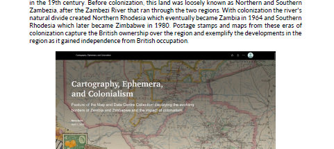
Cartography, Ephemera, and Colonialism
DOI :
https://doi.org/10.15353/acmla.n176.6749Mots-clés :
ArcGIS StoryMaps, Historical Maps, Colonialism, Central Africa, MappingRésumé
This digital exhibit features historical cartographic material and ephemera from the Map and Data Centre of Western Libraries and exemplifies how these materials can be used to discuss, examine, and explore issues or events in history such as the effects of colonialism and the evolution of borders, land designations, and industries through the use of primary source material. It also serves to exemplify the various tools and layouts of StoryMaps, a beneficial ArcGIS tool for showcasing collections, exhibits, and information.
Rhodesia was a landlocked region located in Central Africa, named after the British Colonial administrator Cecil Rhodes, a mining magnate and politician, by the British South Africa Company in the 19th century. Before colonization, this land was loosely known as Northern and Southern Zambezia, after the Zambezi River that ran through the two regions. With colonization the river's natural divide created Northern Rhodesia which eventually became Zambia in 1964 and Southern Rhodesia which later became Zimbabwe in 1980. Postage stamps and maps from these eras of colonization capture the British ownership over the region and exemplify the developments in the region as it gained independence from British occupation.
Téléchargements
Publié-e
Comment citer
Numéro
Rubrique
Licence
© Mars 2025

Cette œuvre est sous licence Creative Commons Attribution - Pas d'Utilisation Commerciale 4.0 International.
Authors retain the copyright to their work by using Creative Commons licenses. The Creative Commons Attribution-NonCommercial license applies to all content unless authors elect to choose a more restrictive license for their work. If you reuse the content, you must give appropriate credit; you may not use or redistribute the material for commercial purposes.